Sacramento: 1910
Posted on April 1, 2010 – 5:15 AM | by OldManFosterBy William Burg Photos courtesy of the Center for Sacramento History
In 1910, Sacramento was a city on the edge of change. Its rowdy Gold Rush era was long past, its role as western terminus of the Transcontinental Railroad superseded by Oakland, and its place as second-largest California city long since lost to Los Angeles. Despite these setbacks, Sacramentans felt that their city was poised for greatness.
 Sacramento’s population in 1910 was 44,000, with another 20,000 in nearby suburbs. By comparison, San Francisco had 416,000, Los Angeles 319,000, Oakland 150,000, San Diego 39,000, and San Jose 28,000. Less than 3.5 million people lived in California. The city limits, established in 1849, ran from the Sacramento River to 31st Street (now Alhambra Boulevard) and the B Street railroad levee to Y Street (now Broadway.) What we now call “the grid” was then the whole city, occupying only about five square miles.
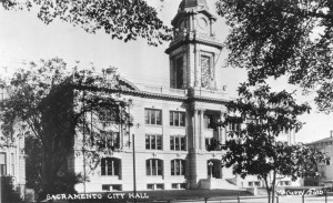
Sacramento’s brand-new City Hall building (now Old City Hall) was occupied by Mayor Marshall Beard, the last “Strong Mayor” of Sacramento. The 1893 “Strong Mayor” charter replaced the 1863 charter’s three at-large trustees with a full-time executive mayor and a legislative board of trustees. This system was promoted by 19th century industrialists who felt that more mayoral power would encourage businesslike efficiency and economy. Beard was sometimes called “Boss Beard,” but many felt the real power was held by Board of Trustees president E.P. Hammond, and E.J. Carraghar, chair of the Finance Committee. Under this system, many residents felt that the city’s best interests took a back seat to big business interests. The big players in 1910 were Pacific Gas & Electric, who held Sacramento’s streetcar franchise and provided its electricity, and the mighty Southern Pacific Railroad, whose shops were Sacramento’s largest employer.
 Started as Central Pacific in 1863 by four Sacramento merchants and a very large federal contract, Southern Pacific held an interstate transportation monopoly in northern California, and had an enormous influence on state and local politics. The Southern Pacific Shops and Locomotive Works produced everything from hand tools to full-sized steam locomotives, and were the main repair and supply facility for SP’s national system. However, when those four Sacramento merchants moved to San Francisco, they took the railroad’s business offices with them. Local reformers felt they had too much influence on city politics, and their monopoly on transportation held Sacramento back, while San Francisco reaped the benefits.
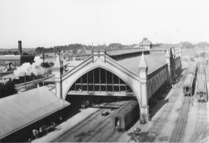
Many Sacramentans hoped that a new transcontinental railroad, Western Pacific, could break Southern Pacific’s monopoly on railroad traffic and spur a real estate boom like the coming of the Atchsion, Topeka & Santa Fe did in Los Angeles in the 1880s. But WP’s arrival did not create a real estate bubble like the one that turned Los Angeles from a quiet ranching town into California’s second-biggest city. Still, the opening of the Western Pacific depot in August 1910 (still standing as the Old Spaghetti Factory) was as welcome as the jobs at the Western Pacific Jeffery Shops in what is now Curtis Park.
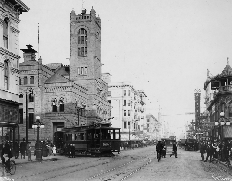
Since cars were still rare in 1910, middle-class commuters depended on the local streetcar system. Consolidated from several smaller companies in the 1890s and powered by a hydroelectric plant in Folsom, PG&E streetcars ran from the heart of downtown on J and K Street, starting near the river or the Southern Pacific depot, with their other ends extending beyond the city limits into the suburbs. PG&E’s streetcars were dwarfed by the larger and faster electric interurban trains. Northern Electric ran north to Chico, and Central California Traction ran south to Stockton, both with stops in the farm communities along the way. Both carried freight as well as passengers. Each also had their own local streetcar lines, mostly serving different suburbs than the PG&E lines. A new bridge crossing the Sacramento River at M Street was under construction, but not completed until 1911. This new bridge was intended for interurban trains and a local streetcar to West Sacramento, and was replaced by the current Tower Bridge in 1935. No electric interurban trains ran to the Bay Area yet, but the River Lines’ steam-powered riverboats, Capital City and Navajo, made the run from Sacramento to San Francisco from the M Street dock.
A wall of warehouses and wharves lined the Sacramento River from I Street to R Street. Front Street was a maze of railroad tracks, transferring goods from Sacramento’s granaries, canneries, breweries, lumber mills and other industries to riverboats and barges. The riverfront was Sacramento’s working heart, from the Southern Pacific Shops on the north end of the city to the Friend & Terry lumber mill on Front and V Street. A second industrial corridor ran along R Street, on the route of the old Sacramento Valley Railroad. The largest industry along R Street was the Buffalo Brewery at 21st Street, the company formed by the elite of Sacramento’s brewing families.
In 1910, the state capitol building lacked its enormous complex of state buildings, but Capitol Park’s grounds included a state printing office and the grand pavilion of the California State Fair. Northern Electric’s interurban and streetcar line ran up M Street to the riverboat docks, through a residential neighborhood that had once been home to Sacramento’s most illustrious names, like Stanford, Crocker, Huntington and Heilbron. By 1910, many of the neighborhood’s grand mansions were subdivided and inhabited by Sacramento’s working class.
Between the capitol building and the waterfront was the West End, a diverse collection of immigrant neighborhoods, railroad hotels, and Sacramento’s original commercial core. In 1910 Sacramento had the highest percentage of Japanese population in California, mostly in a busy Japantown centered around 4th Street. The 1910 city directory even included a special Japanese business section. The Chinese neighborhood, “Yee Fow” or “Second City,” second only to San Francisco’s Chinatown in size, was along I Street. Sacramento’s African American and Mexican communities also called the West End home. Thousands of migrant farm workers and railroad “boomers” lived in boarding houses and hotels close to the river. Ernesto Galarza wrote extensively about the West End in his book Barrio Boy, impressed by its unique diversity and constant activity. Proximity to work, social pressure and racism limited many ethnic groups’ options for places to live, making the West End a crowded place.
 Between the railyards and the West End was K Street, the heart of Sacramento’s shopping and entertainment district. As the only city with many large department stores between Oakland and Reno, Sacramento was a regional destination. Local streetcars and interurban trains shared the street with pedestrians, bicycles, horse-drawn carriages and wagons, and automobiles. Between the department stores and specialty retail shops were theaters featuring vaudeville acts, dance halls, and the new moving-picture theaters. Restaurants and bars in the business district satisfied Sacramentans’ hunger and thirst. K Street also featured hotels catering to travelers and visitors, and apartments for downtown residents. Sacramento’s business district also had its underside, in the form of gambling parlors and brothels. Reformers of the era criticized Mayor Beard as too tolerant of vice in downtown Sacramento, along with accusations of graft and corruption in exchange for votes.
Even in 1910, Sacramento was already straining at its original borders. Until 1902, a levee on R Street had prevented development of the southern third of the city, except on tall Poverty Ridge above flood level. After the levee’s removal, the city south of R Street quickly became a mostly Portuguese and Italian neighborhood, centered on Southside Park, still under construction in 1910. Meanwhile, Poverty Ridge attempted to shed its old name, becoming “Sutter’s Terrace,” a name that never stuck, even as elegant mansions were erected south of the Buffalo Brewery and California Winery. On the northern end of the city, the old state racetrack at 20th and H Street was rapidly becoming the new neighborhood of Boulevard Park, whose distinctive boulevards still grace 21st and 22nd Street today.
Outside the city limits, the new California state fairgrounds on Stockton and Broadway were preparing for their second year, having opened in 1909. 1910 also marked the year when the corner of Y Street and Riverside first became the home of Buffalo Field, later home of the Sacramento Solons, the city’s baseball team until 1960. There were earlier baseball fields, but Buffalo Field (eventually known as Edmonds Field) became iconic as the city’s ballpark. Today, a Target store stands on the site. Farther south on Riverside, at the end of the PG&E streetcar line, was the Riverside Baths, an enclosed swimming pool and bathing facility, opened the previous year in 1909. In March of 1910, residents of the suburb of Oak Park began a campaign to annex the outer suburbs, a move that doubled the size of the city when it passed in 1911.
Even as Sacramento’s first suburbs were being built, developers eyed nearby hop fields, orchards, ranch land and reclaimed floodplains, planning to turn them into Sacramento’s second wave of suburbs. The greatest prize of these, the massive Rancho Del Paso, became available for sale in 1910. Since cars and hard-surfaced roads were still rare, suburbs required streetcar lines. Sacramento’s developers hoped to follow the pattern of Henry Huntington’s Pacific Electric in Los Angeles, or “Borax” Smith’s Key System in the Bay Area, creating a web of suburbs around the urban core linked by streetcar lines and electric power plants. Sacramento land companies generally had ties to streetcar companies and electric power companies, like the newly-formed Pacific Gas & Electric.
1910 was the final year for Sacramento’s old city limits, the monopoly of Southern Pacific, and the “strong mayor” charter. In the coming decades, a series of annexations and waves of suburban development expanded Sacramento to its current size and population, more than ten times that of 1910. A new charter based on a city commission, enacted in 1911, lasted only a decade due to even worse corruption than under Mayor Beard. It was replaced by the first version of our current council/manager system in 1921. Southern Pacific and Western Pacific were both absorbed by competitor Union Pacific in the late 20th century. Railroads and streetcars were eclipsed by airports and highways, and jobs moved from Downtown to the unincorporated county. The old West End was replaced by a host of state buildings and commercial offices, as Sacramento’s dominant business became the government of the nation’s most populated state.
In 2010, Sacramento still seems poised for a greatness that is just out of reach. The same optimism voiced by the boosters of 1910 can still be heard by developers and politicians announcing their latest project, one guaranteed to push Sacramento boldly onto the world stage. In the intervening century, Sacramento did not challenge the size of Los Angeles or the sophistication of San Francisco, but has perhaps learned to appreciate the true and undeniable legacy of the city we have, rather than the city we never became.1910
Tags: History, Mayor Marshall Beard, Sacramento, Strong Mayor, William Burg


2 Trackback(s)