Daytrip: Marin Headlands
Posted on July 1, 2010 – 6:15 AM | by OldManFosterstory and photos by Niki Kangas
Across the banks of the red bluffs, a gentle but unyielding breeze coaxes tall marshy grasses into a tidy comb-over; rainbows of shaking wildflowers bow reverently to the sea. A net of haze blurs the ocean and sky into a blue beyond compare, and there are sighs all around in the company I keep. Amen, we are out of town! No offense, Sac- summer is here, and it begs the question, “Where to this weekend?” If you’re stumped, this article is a big fat suggestion.
 Today we are exploring within the Golden Gate National Recreation Area (GGNRA). An extensive protected region housing infinitely more than one could exhaust in a single daytrip, it became a park in 1972 when Richard Nixon signed a law to protect the lands and allocate $120 million for their development and the acquisition of more land. The National Park Service initially purchased Alcatraz and Fort Mason from the US Army, then annexed the Marin Headlands, site of a failed development project called Marincello that was attempted by the Gulf Oil Corporation. Today, GGNRA’s diverse curiosities plainly chronicle two hundred years of California history. Upon repeat visits or one lengthy one, you could learn about site-specific Native American culture, local flora and fauna, the Spanish Empire, the Mexican Republic, maritime history, military history, the California Gold Rush and the progress of architecture and urban growth in the San Francisco and coastal area. Places to see in GGNRA include Muir Woods, the Cliff House, the Presidio military barracks, Ocean Beach, Mount Tamalpais, and much more.
Located just north of the Golden Gate, it only takes a couple of hours to reach from Midtown, even if you have a couple of kids and their grandma in the backseat. Easiest way to go is to take 80 West to 580 West to 101 South, and exit at the “Sausalito Exit”, just before the Golden Gate Bridge. Turn left at the stop sign, then bear immediately right and head up the hill onto Conzelman Road. Follow signs to Marin Headlands destinations, and to err safely, better refer to your trusty atlas, GPS, or Google Maps too. Don’t forget to bring like, a million dollars for tolls, since the fees are going up again this summer, and you’ll see Toll Booth Willie going and returning. Maps of the Golden Gate National Recreation Area are available at the Marin Headlands Visitor Center. You will notice on these maps that dogs, bikes, and horses are welcome on some of the trails and beaches, so if your ears prick up at any of that, plan accordingly.
A now-defunct military base was first on our list of stops. While heading toward this defensive coastal relic that led the way in the construction of Fort Barry, you will bypass the Nike Missile Site, which is a museum of Cold War reminders. There’s also the Headlands Center for the Arts and Marine Mammal Center to enjoy, neither of which we stopped for, but if you want to make a weekend rather than a daytrip of this adventure, there is a hostel near Fort Barry as well as many free campsites within the extensive trail systems of the Marin Headlands. (We didn’t make it a daytrip either, but a solid overnight trip instead using Haypress Camp to crash, a hike-in site, but on an easy .75 mile trail. The other area campsites are scattered further, and include Hawk, Bicentennial, and Kirby Cove Camps. Call the Marin Headlands Visitors Center at (415) 331-1540 to inquire about campsite or hostel use.)
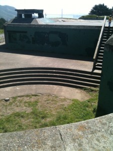
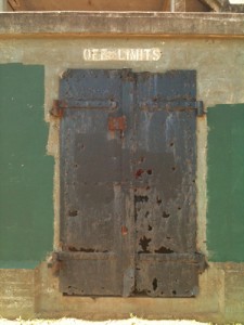
Edification of Battery Mendell began in 1901. By 1905, there were two M1895A4 12-inch breech loading rifles mounted on disappearing cartridges awaiting their first calls to action wherein they could fire 1,100 pound projectiles as much as eight miles away. After World War II quelled fears of imminent invasion, Battery Mendell was disarmed, and for decades, it fell into disrepair and was overtaken by pesky taggers. But our friends at the National Park Service have rolled their sleeves up to restore the old defender, and it’s interesting walking its grounds and imagining what it used to be.
Lunch at the Dipsea Cafe
The Dipsea Cafe, at the intersection where you’ll turn left off Shoreline Highway to head to the trailhead parking lot later, flags the hungry with sunshine yellow patio umbrellas that contrast this blue building by the river. It’s the last place to stop and eat on your way to your hike (or the first place to stop on the way back), so it’s crammed wall to wall with diners- parking was a real bitch, as was hearing my companions’ dinner conversation, but the rent can’t be cheap, so it’s a good thing they’re so busy. Plus, they seem to make their high-priced rent by charging comparably high prices for their fare. In spite of these drawbacks, we enjoyed our meal here very much.
We had to wait momentarily for a table, then were sat on the waterside patio in the glorious noonday sun. Our friendly waitress, even amid the overwhelming assemblage of ravenous people, promptly greeted us. After ordering an Anchor Steam (curiously denoted as an import) and a BBQ Pulled Pork Quesadilla with tomatillo-avocado sauce and sour cream to start, I asked her what was the deal with the restaurant’s name, to which she helpfully replied that the Dipsea Cafe was named for a hiking trail that begins in central Mill Valley.
When she returned with drinks, we’d all decided on entrees. I went for the Nicoise Salad, which starred sustainably harvested Ahi tuna. Everything she brought us was tasty, and we parted a hundred bucks the poorer but well satiated and ready for a hike. Boxed lunches are available, and convenient to grab for a later picnic if you don’t have other dinner plans.
Our next stop was the big legstretcher- we parked the car in Tennessee Valley and kicked rocks. I want to point out that besides my sturdy mate, my hiking party was composed of a two year old, a four year old, and a spiritually hearty but osteoporotic woman upwards of sixty. That said, anyone should be able to throw on some sneaks and hit these trails; this is no great undertaking. Finn, 2, surprised all by rejecting his stroller for three rolling miles where he walked determinedly on his own.
We elected to traverse Tennessee Valley Trail to salty, sandy Tennessee Cove this time around. On a previous trip, I jogged the longer route to Muir Beach, which was a roller coaster of a run to an awe-inspiring destination, about four miles from the trailhead but with elevation gain a-plenty. You can also take the trails to Green Gulch Farm and Zen Center, a facility of Buddhist instruction and organic farming that is dazzling to wander. If you go on a Sunday, a public program is offered that includes zazen instruction, a Dharma Talk, and tea. Attendees are invited to join the community for lunch ($8-$10 donation requested), grown and prepared on site. Pirates Cove is another end to a hike I have yet to take from Tennessee Valley.
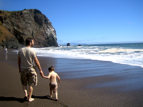
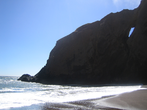
Tennessee Cove unfolded, about 2.5 miles from the trailhead, between the coastal canopy of eucalyptus, the layered, serrated cliffs laced with soapy, green serpentinite, and the billowing azure sky, speckled with the wingspans of ravens. Ships passed quickly out of frame as rock outcroppings encroached. A furious sea lapped up, rabid white, while a fading murky tributary trickled down, refreshing splashing young waders in the shadow of the craggy stone amphitheater. We paused awhile on the beach, littered with more pebbles than sand which vary tremendously in size and color. I scooped a handful, letting them trickle back home through my tickled fingers, and watched the boys play jubilantly. If you’d like to find a pretty grove to have dinner in, use Haypress Camp for its picnic tables and shady solace, which is, oddly, rarely crowded and an easy offshoot on the way back to your car.
 Another dinner idea: check out the Pelican Inn near Muir Beach. It is a quaint, romantic inn that doubles as a cozy English pub and is renowned for its food and service. The beer selection will knock the socks off you hops enthusiasts too.
What did we do for dinner, you ask? Lucky enough to have nowhere to be the next day, we retired to Haypress, used my camping knife to stab open some cans of soup since I left our can opener at work, and heated their contents over a Coleman double burner stove. As we slurped, twilight closed around us, wild sounds filled the dimly lit glen, and we laughed and commended our good little sports.
To plan your Marin Headlands trip, visit: http://www.nps.gov/goga/index.htm
Marin Headlands Visitor Center
948 Fort Barry
Sausalito, CA 94965
The Dipsea Cafe
200 Shoreline Highway
Mill Valley, CA 94941
The Pelican Inn
10 Pacific Way
Muir Beach, CA 94965
Tags: Battery Mendell, DipSea Cafe, Fort Barry, Golden Gate National Recreation Area, Marin Headlands, Niki Kangas


